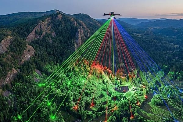
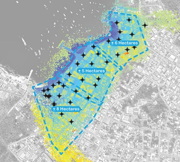
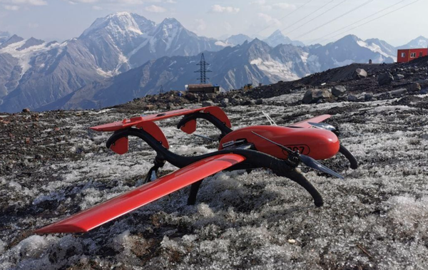
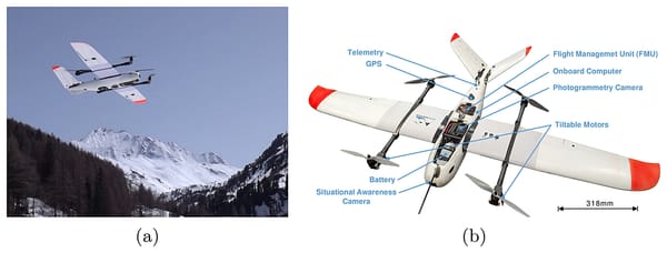
Mapping & Surveying
Wingtra Launches WingtraRAY
Wingtra's new drone, WingtraRAY - the only drone designed specifically for surveyors
Mapping & Surveying
Wingtra's new drone, WingtraRAY - the only drone designed specifically for surveyors
Mapping & Surveying
Fugro RAMMS, the world’s smallest and lightest ‘deepwater’ airborne lidar bathymetry (ALB) system, can now be deployed from vessels of opportunity using a Schiebel CAMCOPTER S-100 uncrewed aerial system (UAS).
Commercial
The FIXAR drone from Latvia claims to outperform other models in its class in both payload capacity and distance coverage.
Commercial
Most UAS applications in Shell have two things in common: they are done by third-party service providers and they take place within the visual line of sight.
Commercial
Geophysics faculty and graduate students from the University of Nevada, Reno, announce new exploration for blind geothermal systems with Unmanned Aerial Vehicle (UAV) magnetometry.
Mapping & Surveying
THURN’s integrated drone-dipping sensor system offers an exciting step change in autonomous data collection
Commercial
senseFly’s eBee Plus drone was used to map the South basin of Lake Winnipeg, thanks to its ability to withstand extreme temperatures while accurately mapping larger areas per flight than any other UAV with a similar weight.
BVLOS
Emesent’s cutting-edge Hovermap simultaneous localisation and mapping (SLAM) autonomous flight system, AL2 enables compatible drones to fly beyond communications range and venture beyond line of sight into unmapped areas.
Mapping & Surveying
Research conducted at the University of North Carolina Wilmington attempts to address the ambiguity associated with SGD point source locations.
Mapping & Surveying
With the democratization of drone technology, landscape architects can play a larger role in creating needed geospatial data sets, rather than just consuming them.
Business
The acquisition of the Global UAV Subsidiaries will be a complementary business to Draganfly and expand Draganfly’s total addressable market and enhance its position as a leader in the UAV and UVS industry
Mapping & Surveying
WingtraOne provided an interesting option for us for many of our research objectives. Its VTOL allowed us to operate from the glacier and from one of the rock ledges.