CASA Approves AirMap Drone Safety App in Australia
“We believe that operators should have a choice in selecting the drone safety app that best meets their needs,”
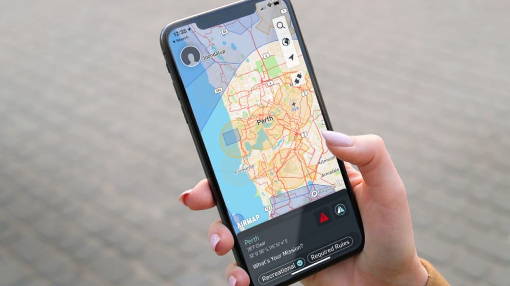
AirMap is now an approved provider of geo-awareness services to operators of unmanned aerial systems in Australia.
As part of CASA’s RPAS platform, AirMap will deliver up-to-date, contextual airspace information to UAS operators so they can visualize airspace advisories and restrictions, plan safe flights that are compliant with CASA regulations, and maintain situational awareness throughout their missions.
AirMap works with Civil Aviation Authorities to digitize, contextualize, and distribute official aeronautical information to UAS operators via publicly available digital formats. With the AirMap for Drones application for web and mobile, UAS operators in Australia can access authoritative data, including controlled traffic regions (CTRs), updates from Australia’s Fire and Emergency Services, information regarding flights over Australia’s marine parks, and CASA advisories, notifications, and regulatory information.
AirMap is one of four initial participants in the RPAS digital platform.
“We believe that operators should have a choice in selecting the drone safety app that best meets their needs,” added Peter Hogewoning, Vice President for Asia Pacific at AirMap. “We applaud CASA’s innovative approach to promoting airspace safety and look forward to working together to safely integrate drones into the Australian airspace system.”
Source: Press Release